
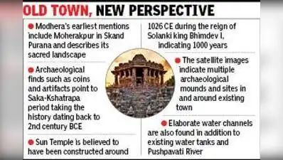
Ahmedabad: For a long time, Modhera has been defined in the public imagination by the Sun Temple—its sculpted grandeur and the Surya Kund that anchors the complex. A new GIS-based study argues the monument is only the most visible layer of a far older and more complex settlement: a fortified, planned town in north Gujarat with an elaborate system for storing and moving water in a semi-arid landscape.
The study—“Revisiting Modhera (Ancient Moherakpura), Gujarat, Using Old Maps and Geospatial Analysis”—has been published as a book chapter in Springer’s “Spatial Narratives of India’s Heritage: Integrating Geospatial Analysis in the Humanities. Prof Prabhakar said they reconstructed the settlement as a cultural landscape by combining archaeological evidence, old survey maps, satellite imagery, digital elevation models, hydrological analysis, literary traditions and field verification to get an idea of ‘ancient geography progressively obscured by modern habitation and landscape change. Rai said that one of the focus areas of the study was water management and current and ancient water channels and reservoirs.
The authors are Shikha Rai, a post-doctoral fellow at IIT-Gn’s Archaeological Science Centre, and the centre’s coordinator Prof VN Prabhakar. “Apart from the existing lakes, we also get a peek at the floodplain of the town, pointing at a very active and thriving water conservation and distribution system. The town is even today in a semi-arid zone, and water must have remained a major concern for the population,” she said.