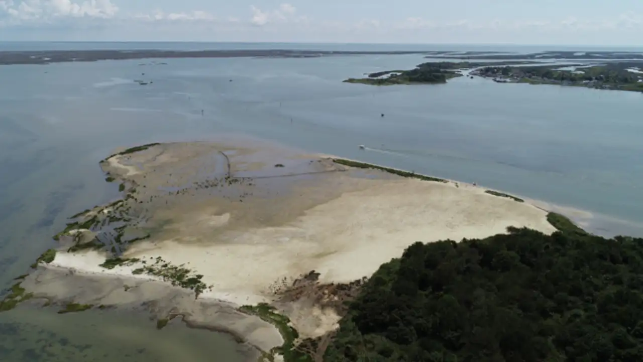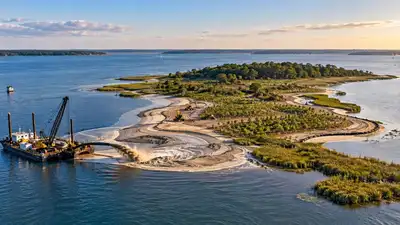
Then, in 2018, a routine dredging operation created an unusual opportunity. By the following year, roughly 60,000 cubic yards of dredged material had been placed across about 12 acres, followed by extensive planting to turn the rebuilt ground into marsh and dune habitat, according to National Centers for Coastal Ocean Science (NCCOS). Swan Island does not sit far from the water it was meant to help protect. In Maryland’s Tangier Sound, the low-lying island forms part of the landscape around Ewell, a small community reached only by boat. Years of erosion and sinking ground had reduced the island’s size and weakened its natural role as a barrier against wind and waves. Instead of sending the sediment elsewhere, engineers used it to rebuild Swan Island.
The US Army Corps of Engineers Baltimore District began dredging them in 2018 as part of the area’s regular 10-year dredging cycle. Around 60,000 cubic yards of sediment were eventually used to raise and rebuild approximately 12 acres of Swan Island. As reported by US Army Corps of Engineers, the response was to add another 25,000 Spartina alterniflora plants to the low-marsh areas. Swan Island’s restoration was completed in 2019, but its performance was being assessed long after the machinery had left the site.
Because of its relationship with Ewell, the location of the island mattered. Restoring Swan Island therefore involved more than replacing lost vegetation. The restoration was tied to work on the Big Thorofare and Twitch Cove navigation channels. There was a practical problem behind the decision to use the material at Swan Island. The facility traditionally used to contain dredged sediment had reached capacity. Rather than treating the sediment simply as waste from navigation work, project partners looked for a location where it could serve another purpose. Swan Island provided that opportunity. The island had already been losing ground through shoreline erosion and subsidence, while the dredged material could provide the volume needed to rebuild its footprint. The approach also linked two different needs. Keeping the navigation channels open was necessary for Ewell, while restoring the island could help recover habitat and maintain some of the protection it provided against wave action. The work changed an increasingly fragmented landscape into a mixture of higher and lower marsh, together with dune areas. The material arrived through a pipeline and was then mechanically graded to bring the surface towards the required elevations. The restoration was not simply a matter of piling sediment onto the island. Engineers also had to contain it during construction. Two layers of coconut-fibre logs, secured with wooden stakes, were used around the restored area. Their purpose was to hold the newly placed sediment in position and reduce the risk of material moving into nearby submerged aquatic vegetation. Swan Island is part of the Martin National Wildlife Refuge and lies in Tangier Sound, where winds commonly arrive from the northwest. Those winds can travel across the island towards Ewell, creating conditions in which waves reach the community. As erosion reduced Swan Island, the island’s ability to interrupt that wind and wave energy was also being affected. Ewell’s dependence on water access added another layer to the project. The community is accessible only by boat, making reliable navigation through the federal channel particularly important. The project was also intended to examine whether rebuilding the island could improve its physical function as a coastal feature. The work did not end when the planting was finished. Agencies involved in the project set up a monitoring programme to track what happened to the island after construction. The US Army Engineer Research and Development Center, NOAA’s National Centers for Coastal Ocean Science, the US Fish and Wildlife Service and the Maryland Department of Natural Resources contributed to the effort. Measurements covered features such as sediment, ground levels, water movement and ecological conditions. The information was used to build models examining how Swan Island could affect wave energy and erosion around nearby shorelines and habitats. Workshops involving the different agencies eventually produced a Monitoring and Adaptive Management Plan, intended to guide observations and changes to the restoration approach as conditions developed. After two years of monitoring, the high marsh was showing strong growth of the planted Spartina patens. The lower marsh was less successful, with substantial mortality among the smooth cordgrass. Rather than treating the original planting as a finished result, the restoration team used the monitoring information to alter the work. Shoreline erosion, changes in elevation and the spread of vegetation continued to be tracked alongside tides, inundation and wave activity. These measurements were intended to show how the reconstructed island was responding to the conditions around it. The project was designed to provide information that could be applied to other coastal islands facing similar pressures from erosion, storms and rising water levels. You use AI every day. Now get your AI Quotient. Take the AIQ test.
PC: NOAA Native vegetation was introduced from late spring in 2019, as reported by NCCOS. The project involved a substantial planting effort, with about 200,000 plants used across the restored landscape. The island was divided into four planting zones, reflecting the different elevations and conditions expected across the site. The dunes occupied the highest ground, followed by a transition zone and high marsh, with low marsh closer to the water. American beach grass was used in the dune zone, while switchgrass was planted in the area between the dunes and high marsh. The higher marsh received salt-meadow cordgrass, or Spartina patens. Smooth cordgrass, Spartina alterniflora, was selected for the low marsh. The final planting arrangement differed somewhat from the original plan. The sediment turned out to be sandier than expected, and placement was less precise than intended in some areas. This left parts of the island at a higher elevation, affecting which plants could be established successfully. Some shoreline sections beside the dunes were also reinforced with armouring to provide further resistance to erosion.