One project is being changed before it’s finished and another is being redone after commuters began using it.
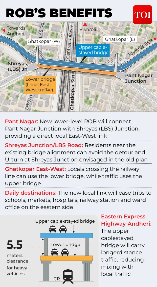
After the work on Mumbai’s Ghatkopar road overbridge is almost 30% complete, it is being redesigned. In Delhi, Barapullah Phase-III opened with a promise of a 15-minute journey but within days of opening, it is facing serious congestion. The original plan had a 2+2-lane cable stayed bridge as the main east-west connection. The main bridge will be raised a few meters and widened to a 3+3-lane configuration to accommodate heavier volumes of through-traffic.
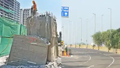
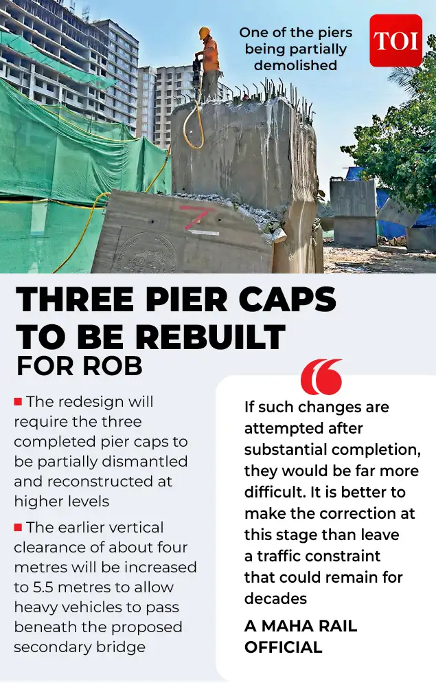
Because the main bridge is designed primarily for vehicles travelling across the area, nor should residents have to take a longer detour simply. The Mumbai Traffic Police says it has to deal with over 2.7 million vehicles across the city every day, while Ghatkopar itself has had to impose temporary one-way restrictions recently due to heavy movement of vehicles on local roads. Mumbai and Delhi are asking the same uncomfortable question from either end of two big road projects: did planners consider how people would actually use the roads? One project is being changed before it’s finished and another is being redone after commuters began using it. The Ghatkopar redesign is significant as it involves changing a structure that is already under construction. Three pier caps – RP15, RP16 and RP17 – will need partial demolition and rebuilding at a higher level. Instead, the revised plan creates a two-tier setup, separating local traffic between Ghatkopar East and West from longer-distance traffic between the Andheri side and the Eastern Express Highway. Mumbai’s lesson The logic behind the Mumbai redesign is simple. A resident travelling from Ghatkopar East to West to attend school, visit a market, hospital, railway station or ward office should not have to mingle with traffic passing through the area. The proposed lower-level road overbridge between Shreyas (LBS) Junction and Pant Nagar Junction is meant to address just this problem of local movement. It is an acknowledgment that a road corridor can have two very different types of user: those passing through the city and those making short, everyday trips in their own neighborhood. Delhi’s lesson
The 3.5-km-long elevated corridor is planned as a major connectivity project connecting Mayur Vihar Phase-I with Sarai Kale Khan. Official estimates have said that journeys toward AIIMS could be reduced from around 35-40 minutes to around 15 minutes. Instead, tailback of almost 3km was reported shortly after opening, with commuters reporting journeys of 40 minutes or more. The police finally asked commuters to use NH-24 and the DND Flyway. Mumbai’s new Ghatkopar bridge is being planned for an 80 to 100-year horizon while Delhi’s Barapullah project was expected to change the way people move between East and South Delhi.
You Can Also Check: Gold Rate in Delhi | Silver Rate in Delhi | Bank Holidays in Delhi | Public Holidays in Delhi | Delhi AQI | Weather in Delhi | Petrol Price in Delhi | Diesel Price in Delhi | CNG Price in Delhi | LPG Price in Delhi Stay updated with the latest Delhi news.
Delhi Traffic Police said Google Maps was not showing the congestion and kept directing motorists to the corridor. Barapullah Phase-III presents the problem from the other side. The bigger Barapullah network is expected to provide a largely signal-free route to South Delhi. The problem appears to be not just the amount of road space available, but what happens when different streams of traffic converge. A joint inspection by Delhi Traffic Police and PWD, with the help of drone footage, found the merger point near Sundial Park as a major bottleneck where traffic from the multiple-lane elevated corridor merges into a narrower existing section, with vehicles from other directions also joining the same stretch. The result is a classic urban traffic problem. Capacity at one point, but an unresolved conflict at the next. The awkward question in both the cities The striking similarity between Ghatkopar and Barapullah is that the problem is not whether a bridge or an elevated road is needed. Both are real traffic needs. The bigger question is whether road planning is keeping up with the complexity of urban movement. Mumbai has opted to alter the Ghatkopar design before its completion, necessitating demolition and additional work to prevent an expected clash between local and through traffic. Now Delhi is trying to manage a conflict that only came into view after thousands of motorists entered the corridor. The Barapullah experience has also shown another modern problem – navigation technology can make a road-design problem worse. Possible short-term measures being considered include an additional lane, a dedicated U-turn and changes to traffic management at the merger. There’s a bigger lesson here for India’s fast growing metros. But infrastructure for long-life cannot be measured by how many lanes it has or how fast a vehicle can travel on a stretch. It has to explain where those vehicles are coming from, where they are joining, where they are turning, and why local inhabitants use the road differently than passing commuters. Hence the difference between the two cities matters. Delhi is finding out that a road built to save time can also become a bottleneck at its most crucial intersection as traffic has begun to move. In both cases, the real test of infrastructure is not the opening, the length of the bridge or the number of lanes. This is what happens when the city actually takes the wheel. Download the TOI App.
Mumbai is spending more time and energy now to change a bridge before the traffic starts flowing.