
Rampur, Ghaziabad and Moradabad achieve 100% of their farmer registry targets as Uttar Pradesh crosses 2.5 crore digital farmer registrations
Uttar Pradesh’s digital agriculture transformation is gaining significant momentum, with Rampur, Ghaziabad and Moradabad emerging as the state’s leading districts by achieving 100 percent of their prescribed targets under the Farmer Registry. These three districts have completed 100 percent of their prescribed farmer registry targets, placing them at the forefront of Uttar Pradesh’s digital agriculture mission. Against the Central Government’s target of 2,88,70,495 farmers, the state has so far registered 2,50,81,576 farmers. This represents approximately 86.88 percent of the prescribed target. Around 37.89 lakh farmers are still to be brought into the registry. With more than 2.50 crore farmers already registered, Uttar Pradesh has created a large digital foundation for future agricultural interventions. Of the state’s 1,08,935 villages, geo-referencing of 95,765 villages has been completed in accordance with revenue records. After excluding villages affected by surveys and consolidation proceedings, 93,187 villages were found to be surveyable. With nearly 87 per cent of the state’s target already covered, Uttar Pradesh is moving steadily towards building one of the country’s largest digitally connected agricultural ecosystems. Their 100 percent achievement can serve as a benchmark for the remaining districts as Uttar Pradesh moves towards a more transparent, data-driven and technology-enabled agricultural economy.
Because it demonstrates that complete digital registration of farmers is possible at the district level when administrative machinery, revenue records and grassroots mobilisation work together, the achievement of Rampur, Ghaziabad and Moradabad is particularly significant. Because land ownership and cultivation-related records can change over time, this is important. The focus now is on completing the remaining registrations and ensuring that the information remains accurate and updated. The government is also working on a dynamic farmer registry, under which farmer information will be updated on the basis of changes in the records of rights. Keeping these details updated can help reduce discrepancies and ensure that government assistance reaches the intended beneficiaries.
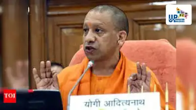
The achievement marks an important milestone in the Yogi Adityanath government’s efforts to build a technology-driven agricultural ecosystem in which farmers, landholdings and crop information are digitally connected. The farmer registry is a key component of AgriStack, the national digital agriculture architecture being implemented in Uttar Pradesh. By creating a reliable digital identity for farmers and linking it with land and crop-related information, the system is expected to make the delivery of government schemes more transparent, targeted and efficient. Their achievement provides a model for other districts that are working to complete the remaining registrations. The farmer registry is not merely a database-creation exercise. It is intended to become the foundation of a broader digital system through which farmers can be more accurately identified and connected with agricultural schemes and services. Uttar Pradesh has set an ambitious target for bringing farmers into the digital agriculture ecosystem. The scale of the achievement is substantial. The success of Rampur, Ghaziabad and Moradabad offers a clear indication of the pace at which the remaining gap can be bridged. A major objective of AgriStack is to digitally connect farmers, land parcels and farmer categories through the farmer registry. This will allow information related to farmers and their landholdings to be maintained in a more systematic manner. For farmers, a robust digital registry can eventually mean less dependence on repeated documentation and physical verification for accessing eligible government programmes. For the administration, it can provide a more reliable basis for planning, targeting and monitoring agricultural interventions. The digital agriculture initiative extends beyond farmer registration. Uttar Pradesh is also making rapid progress in the geo-referencing of villages. The remaining challenge is to complete registration, continuously update farmer and land records, and convert the resulting database into practical benefits. The experience of Rampur, Ghaziabad and Moradabad provides a strong foundation for answering that question.
Of these, geo-referenced maps of 92,853 villages are already available on the DCS portal. The fourth use case, Pradhan Mantri Fasal Bima Yojana (PMFBY), is yet to go live.Thus, three out of four priority use cases—75 percent—have already been implemented. Local administrations can therefore identify practical applications of digital data that respond to specific agricultural challenges. The 100 percent Farmer Registry achievement of Rampur, Ghaziabad and Moradabad therefore represents more than a numerical milestone.
You Can Also Check: Gold Rate in Lucknow | Silver Rate in Lucknow | Bank Holidays in Lucknow | Public Holidays in Lucknow | Lucknow AQI | Weather in Lucknow | Petrol Price in Lucknow | Diesel Price in Lucknow | CNG Price in Lucknow | LPG Price in Lucknow Stay updated with the latest Lucknow news. This digital mapping exercise can strengthen the connection between land records and agricultural data. When farmer information is linked with accurately mapped land parcels, the government can develop a more precise understanding of agricultural resources and production patterns at the grassroots level. The state’s digital agriculture architecture is also moving from database creation towards actual utilisation. Under the four priority use areas identified through SASCI, Fertiliser Management, Minimum Support Price and Agricultural Production Estimation have already gone live. This transition is crucial. The ultimate value of digital agriculture will depend not simply on the number of farmers registered but on how effectively the data is used to improve agricultural planning, scheme delivery and farmer services. The Yogi government is now looking at taking the digital agriculture initiative beyond registration and record management through the use of artificial intelligence and data analytics. Plans are being developed to integrate crop, weather, agro-climatic and other relevant datasets. Such integration could help create possible production scenarios and generate market intelligence. For example, combining crop information with weather and agro-climatic data could support better estimates of agricultural production and help policymakers anticipate potential changes in output. Market intelligence can, in turn, support more informed decisions relating to agricultural planning and supply chains. The proposed approach reflects a broader shift—from simply digitising government records to using data for decision-making. To ensure that AgriStack data is fully utilised, proposals have been made to establish task forces at the district, state and central levels. These task forces are expected to include young officers, agricultural experts and other stakeholders associated with the Digital Agriculture Mission. The emphasis on district-level innovation is especially important. Uttar Pradesh’s agricultural landscape varies considerably from one region to another. The government has encouraged these task forces to develop new examples of effective data utilisation over the next three to six months, which can subsequently be integrated at the state and central levels. It is a demonstration of how digital governance can be taken from policy documents to the grassroots. Download the TOI App.