
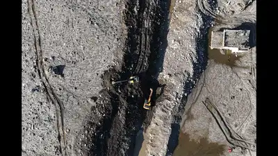
ICIMOD satellite analysis detected instability nearly seven weeks before Aug 26 disaster; SMS warnings reached residents after debris flood swept through border corridor. (AFP)
A Himalayan mountain slope had shifted by up to 40cm over 48 days before it collapsed, triggering the devastating Aug 26 flood in Nepal’s Rasuwa district, a scientific assessment released on Tuesday by International Centre for Integrated Mountain Development (ICIMOD) found. The disaster killed at least 1,451 people in Nepal and left 5,745 missing, while another 43 died and 519 remained missing in China.
The findings indicated that satellite monitoring could detect unstable slopes weeks before collapse, though scientists said predicting the precise timing remained difficult.
The preliminary report, Understanding the Gyirong-Rasuwa Disaster of 26 August 2026, analysed Sentinel-1 satellite radar observations from July 7 to Aug 24 and recorded ground movement of up to 40cm along the satellite’s line of sight. At 8.37am on Aug 26, an estimated 132 million cubic metres of rock and glacier ice broke away from the northern face of Langtang Lirung and plunged into Lhende Khola valley, sending a torrent of debris downstream. The surge reached the border corridor in approximately seven minutes, but authorities issued SMS warnings only around 9.15–9.16am — nearly 38–39 minutes after the collapse and about half an hour after the flood reached the corridor. Researchers identified geological weaknesses, possible damage from the 2015 Nepal earthquake, thawing permafrost, glacier changes and snow accumulation as potential contributing factors, but could not establish a single trigger. The findings came two days after another major rock-ice avalanche and flood struck Nepal’s Budhi Gandaki basin on Oct 11, raising concerns about the monitoring of unstable slopes across the Himalayas.
Researchers said conventional early-warning systems focused on rainfall and river levels were inadequate for detecting sudden mountain collapses capable of generating fast-moving debris floods. “This tragedy shows that some dangerous mountain slopes may exhibit measurable signs of instability before catastrophic failure,” said ICIMOD director general Pema Gyamtsho. ICIMOD scientist Qianggong Zhang said satellite-based monitoring could help identify other potentially unstable slopes for closer observation, although researchers could not reliably determine when they might collapse.
The deformation pointed to growing instability in the rock and ice mass before its collapse. The assessment drew on satellite imagery, seismic records, drone surveys, hydrological analysis and field investigations. The study ruled out a conventional glacial lake outburst flood, initially suspected as the cause. Instead, a massive bedrock failure dislodged part of an overlying glacier, triggering a cascading flow of rock, ice, water and sediment through the valley. A joint scientific field investigation involving ICIMOD and Chinese researchers was scheduled to begin this week to examine the disaster site and identify other potential hazard hotspots across the Himalayan region. You use AI every day. Now get your AI Quotient. Take the AIQ test.