
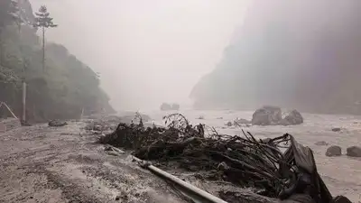
In this photo released by Xinhua News Agency, a muddy river bank with debris is seen near Gyirong Port in southwestern China’s Tibetan Autonomous Region.
China’s national meteorological centre forecast rain in Gyirong county through Aug 29, with moderate to heavy spells during some periods.
China’s ministry of water resources said it was tracking the lake and running flood simulations to assess the impact of a possible breach. Meanwhile, Basanta Raj Adhikari, director of Centre for Disaster Studies at Tribhuvan University in Nepal’s capital Kathmandu, warned that “second and third waves” of floods could hit if fresh landslides triggered another surge. “We don’t know yet,” he said, adding that he was in touch with colleagues in China monitoring developments. Adhikari said the episode showed how difficult such Himalayan hazards remained to predict. “Climate change is really happening here,” he said.
Chinese engineering teams used drones, portable satellite equipment and 3D laser scanners to map the blockage. The footage showed masses of brown water accumulating in a basin with no visible outlet. The weather outlook added to the concern. Xinhua quoted chief forecaster Ma Xuekuan as saying afternoon conditions could also bring thunderstorms, strong winds and short spells of intense rainfall.