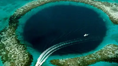
Marine biologist Johnny Gaskell discovered a massive 150-meter-wide blue hole in the Great Barrier Reef using satellite imagery on Google Maps. Image credits: Wikimedia Commons
In 2017, marine biologist Johnny Gaskell, working from the Whitsunday region in Queensland, searched for areas where coral could have survived Cyclone Debbie. How Gaskell used Google Maps satellite view after Cyclone Debbie in 2017 Google’s Maps blog says Gaskell used satellite view in 2017 to trace Cyclone Debbie’s path and pinpoint areas along the reef that may have been spared from damage. The dive about five months later: a hole 150 metres across and at least 20 metres deep In that post, quoted by Australian Geographic, Gaskell wrote that a category 4 cyclone had gone straight over the area just five months before the dive. At depths of 15 to 20 metres, he saw huge birdsnest corals ( Seriatopora ) and very elongated staghorn corals ( Acropora ), which he described as among the biggest and most delicate colonies he had seen. SBS reports that Gaskell could explore the hole for only about an hour at high tide, when conditions were safest and measured it at 150 metres across and at least 20 metres deep, adding that it needed another visit to establish its true depth. National Geographic later reported the hole as just shy of 100 feet deep at its centre, or roughly 30 metres. The same post, as quoted by ZME Science, places the hole over 200 kilometres from Daydream Island, in one of the least explored parts of the reef. Earlier geological work on blue holes in the Pompey hard line reefs The 1979 study Drowned dolines: the blue holes of the Pompey Reefs, Great Barrier Reef describes two blue holes at Cockatoo and Molar Reefs in the Pompey hard line reefs. They are roughly circular, between 240 and 295 metres across and 30 to 40 metres deep. The paper adds that both features were mapped in detail during an October 1977 expedition using echo-profiling, scuba exploration, sediment coring, seismic refraction and shallow drilling. Cockatoo is completely rimmed by living coral, while Molar is only partly rimmed and seismic refraction across the rims revealed a shallow pre-Holocene surface 8.5 to 11 metres beneath them. There are two outer shelf reefs that have seen an increase in hard coral cover since 2017, which suggests little damage. In the study, two surveys on four reefs found a sector-wide median hard coral cover of 10-30%, with no crown-of-thorns starfish recorded and only low, scattered bleaching on half the reefs surveyed. The paper also notes a stark contrast between sites: Hayman Island fell from 37% coral cover to 5% after Cyclone Debbie, while the outer-shelf reefs Rebe and Slate Reef showed increases from 2017 levels.
Because sediment builds up in them over thousands of years, this fits what Gaskell told National Geographic: blue holes can be like time capsules for the ocean. Because an influx of divers would severely damage colonies he described as more delicate than usual, gaskell has said he will not disclose the location of the hole. Gaskell reported large, delicate staghorn and birdsnest colonies inside the blue hole about five months after Cyclone Debbie. Until a scientific study is released, the function of the hole as a shelter is only a hypothesis based on a single dive report.
Gaskell dived into one of the spots and said he found large, fragile colonies of coral that had survived the cyclone. The blog adds that only two blue holes had been documented in the Great Barrier Reef until a few years earlier and describes Gaskell and a team of researchers as finding previously unknown ones, although Gaskell wrote in an Instagram post that geologists had already described and documented the hole he dived and said his team may well have been the first to dive it. The record’s summary says the holes are collapsed dolines that may have taken more than one period of low sea level to form. Image credits: Wikimedia Commons The record also says the inner slopes include sediment fans and terraces at depth. In his post, Gaskell said geologists had mentioned the craters before, but the sources do not say whether this is one of those two features or whether it is smaller.
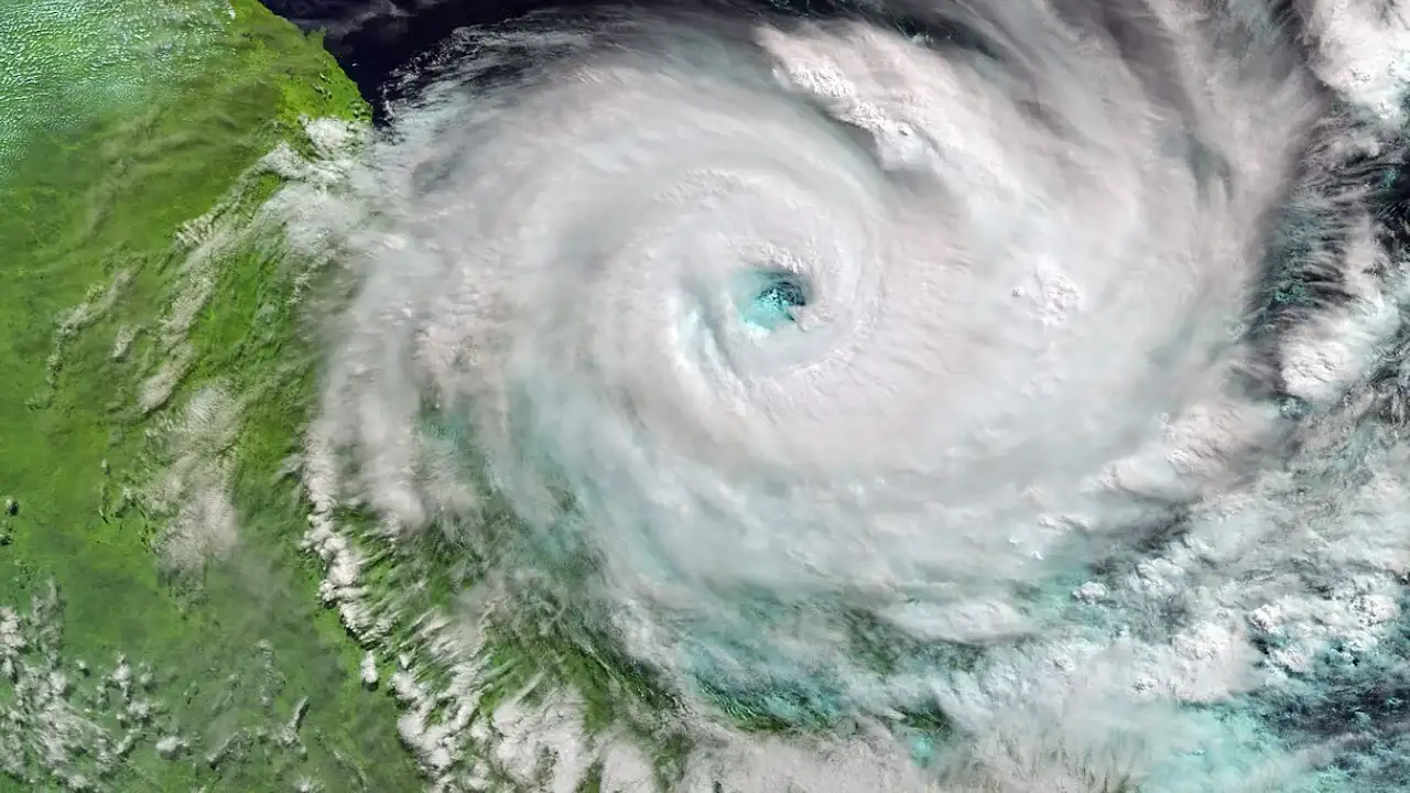
Tropical cyclones can break apart branching corals and strip reef flats and the damage differs from one reef to the next depending on depth, exposure and the path of the storm. He used the satellite view in Google Maps to locate blue holes, which are deep circular structures that appear as dark spots in the lighter water of the lagoon surrounding them. Most of what is known about the find comes from his own observations and from reports of them. There he spotted perfect circles, indicating a possible blue hole, in the Hard Line Reefs south of the Whitsundays, a difficult-to-reach area that is dangerous to navigate. The team then used satellite view on their phones to steer through narrow channels in unsurveyed waters until the blue dot sat over the hole. He suggested that their survival was a result of the hole’s position within the lagoon walls. Gaskell’s explanation of the hole’s protective effect is his own interpretation. Staghorn coral (Acropora). How uneven Cyclone Debbie’s damage was across Whitsunday reefs The Australian Institute of Marine Science published the Report on surveys of the Whitsundays sector of the Great Barrier Reef , covering four reefs surveyed after the cyclone. This clearly shows the uneven distribution of damage. Reefs in the outer Whitsundays showed high, diverse coral cover with little evidence of cyclonic damage. This patchy pattern allows for the existence of a sheltered area, but does not give an explanation for it. You use AI every day. Now get your AI Quotient. Take the AIQ test.